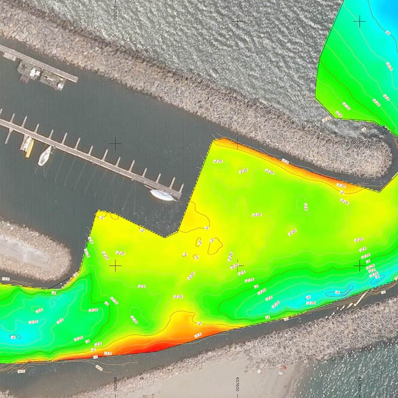
Bathymetry
Our bathymetry service is used to measure seabed features such as landforms, excavation and embankments, as well as to map riverbeds.
We use a dual-frequency HydroLite-Tm echo sounder that combines low frequency (30 kHz) and high frequency (200 kHz) transducers in a unit that allows penetration of soft sediments to detect harder layers and the surface layer.

HydroLite-Tm type echo sounder
This uniquely designed tool is useful for classifying bottom types. It allows us to record depths from 30 cm to 200 m with a higher degree of accuracy than the standard system. This tool performs rapid hydrographic surveys in marinas, lakes, rivers, ponds, harbour approaches, around bridge piers, etc. This system allows us to meet the many demands of our clients on their various projects.
Applications
- River erosion monitoring
- Excavation monitoring
- Accumulation of ore near the docks
- Seabed mapping
- Volumetric calculation
- Survey as built
- Landslide
- Surveillance and site monitoring
Benefits
Quick and easy to use
Georeferenced survey
Seabed topography
Useful before and at the end of the project
3d report of the seabed
Creation of a 3D grid of the funds
Contour lines and cross sections
Accuracy from 1 cm to 5 cm
River bathymetry
Sectors
- Municipal
- Civil engineering
- Port
- Environment
- Energy
Contact us
now!