About us
3D scanning is revolutionizing the methods of taking measurements in all sectors of activity. These high-performance instruments can capture millions of points in record time using various technologies. At Geomog we have been using 3D scanners for more than ten years and we apply this technique in all spheres of activity.
Modeling allows you to take advantage of the full potential of 3D scanning technology. Two distinct segments represent our service offering.
The first is the production of 3D models of buildings from point clouds obtained using 3D scanner surveys. This method is commonly called “Scan to BIM” and is used to reproduce the existing conditions of a building for professionals working on the design plans. It is possible to produce 3D models from other sources of information such as traditional surveys, annotated plans and even photographs. One of our specialties is the updating of design models as part of BIM management projects in order to coordinate the work and produce a final model (as built).
The second segment is the creation of polygonal models representing with great precision objects and equipment of all kinds for manufacturing, analysis and maintenance purposes. We produce a 3D model from surveys carried out using different 3D scanning technologies in line with the precision needs of the project. This mainly results in parametric surfaces compatible with software solutions such as Solidworks and Inventor.
Finally, some projects may require the combination of technologies and modeling methods. Motion over time analyzes and the integration of equipment inside models are good examples.
Levels of development (LOD)
The Level of Development (LOD) aims to establish the standards necessary to determine the scope of BIM projects. These standards may vary from country to country. At Géomog, we base ourselves on the work of the American organization BIM Forum. For more information, visit the Bim Forum website.
Since we mainly model existing building and infrastructure environments identified by 3D scanner (scan to BIM), we have established specific levels of detail adapted to the needs of our customers. These levels are related to the limits of our service offer as a surveying firm.
Level 1: Similar to LOD 100, level 1 is the modeling of rough shapes in order to analyze space constraints and facilitate the study of the infrastructure or the urban model before the start of the project.
Level 2: Falls between LOD 100 and 200, Level 2 is the modeling of building openings (doors, windows, etc.) and general shapes for planning purposes.
Level 3: Between LOD 200 and 300, level 3 is the modeling of visible elements up to 40 millimeters in size. Mainly suitable for models of existing buildings for architects and engineers.
Level 4: Between LOD 300 and 400, level 4 is the modeling of objects up to 15 millimeters in size. Mainly suitable for BIM coordination projects and 3D models representing, among other things, the final works (as built).
Level 5: Modeling of visible elements up to 30 microns in size. Mainly suitable for machining, reverse engineering and deformation documentation in mechanical engineering in the industrial environment.
Our expertise applies to the following business sectors:
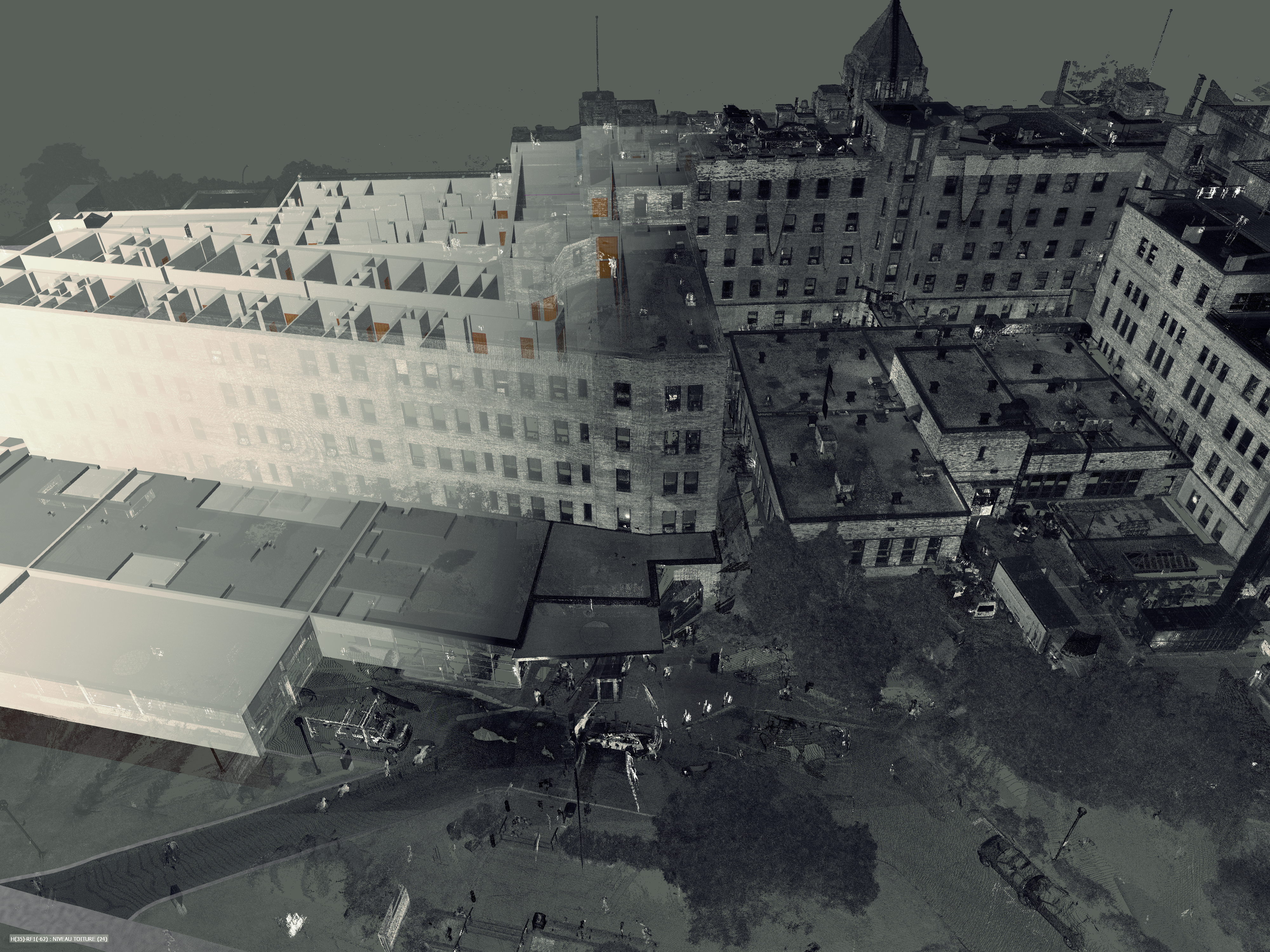
The 3D scan makes it possible to represent a building in the form of point clouds. We can then produce a 3D model, 2D plans, a demonstration of verticality and flatness as well as analysis of movement over time.
The 3D scan makes it possible to take precise measurements of a civil engineering project. The level of detail obtained is very useful for both early and final (TQC) surveys of existing conditions. In addition, this technology allows quantities to be calculated with greater accuracy than conventional methods.
The data collected from 3D scanners makes it possible to produce 3D models of equipment for planning, maintenance and deformation analysis purposes. We also use this technology to produce factory plans to facilitate the development of infrastructure and industrial equipment.
3D scanning helps protect cultural heritage by creating digital copies of works of art and heritage places. Projects to convert a church into a multifunctional center as well as those to relocate or renovate a historic building greatly benefit from the advantages offered by the level of detail obtained.